Main Sections
Black-tailed Deer
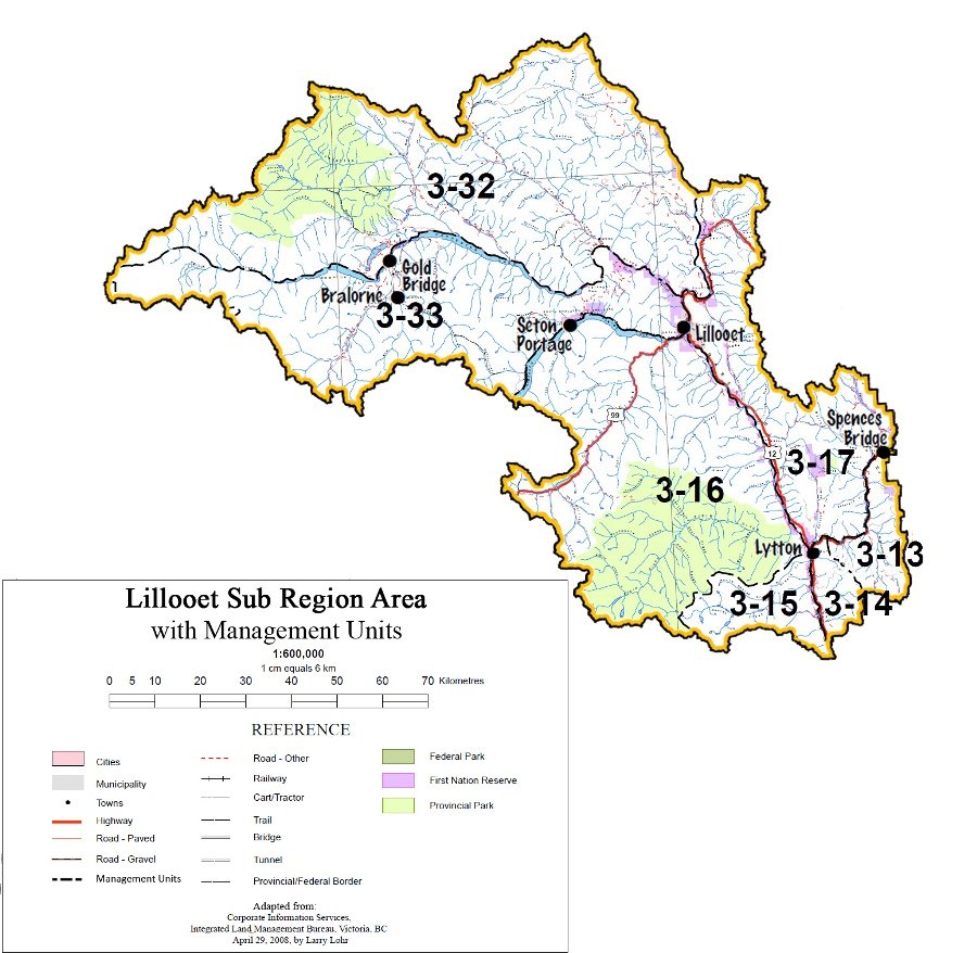
The current population is estimated at 8,000. Snow depth can limit black-tailed deer movement, making winter range areas with low snow levels and adequate forage important for black-tailed deer survival. Winter range (see map) is considered a limiting habitat factor, but others include habitat degradation, predation, unregulated harvest and disease. Black-tailed deer are distributed throughout management units 3-16 and 3-15 of the Sub Region.
General issues across the Sub Region will be addressed below, followed by management plans specific to local populations.
Issues:
- High predation of black-tailed deer is putting local populations at risk
Goals:
- Undergo ungulate enhancement measures
| Objectives | Management Direction/Strategies | Measures of Success/Targets | Intent |
|---|---|---|---|
| 1. Maintain mule deer winter range areas shown on the Mule Deer map | 1.1 Designate the mule deer winter range capability areas shown on Mule Deer as “ungulate winter range” under the Forest and Range Practices Act | Mule deer winter range management achieved using the timber harvesting land base planning allowance of 6,000 hectares | |
| 1.2 Consider available First Nations’ knowledge of mule deer winter range in the designation | |||
| 2. Ensure snow interception, thermal and security covers are well distributed over the mule deer winter capability range (see Mule Deer map) | 2.1 WLAP through consultation with appropriate ministries will develop winter range planning cells of approximately 200 – 600 ha | Planning cells of approximately 200 to 600 hectares in size are established within winter range | Snow interception, thermal and security covers are important so that deer are able to avoid deep snowpacks, find food not yet buried in snow, moderate temperature and hide from predators. |
| 2.2 Crown closure less than class 5 (46%) and age class less than 8 are not considered suitable for snow interception Where practicable, utilize old stands with the highest crown closures | |||
| 3. Manage resource development and use activities by providing well distributed and accessible snow interception and security cover within winter range planning cells, particularly in areas with deeper snowpacks | 3.1 Priority should be given to areas identified as higher value shelter (see Mule Deer map) | Adequate snow interception and security cover within winter range | Adequate snow interception cover is typically comprised of Douglas fir stands with a minimum age class 8 (140 years) with 46% or greater canopy closure Sample calculation: (33% +15%) ÷ (moderate snowpack ha ÷ assessment unit). If moderate snowpack is less than 10% of the assessment unit, them the whole unit is managed to the low snowpack strategy percentage. The weighted average percentage in the moderate snowpack zone can never be less than 20% (the only exception being when the moderate is less than 10% of the assessment unit) |
| 3.2 Where biodiversity objectives can be met, wildlife tree patches should give priority to Douglas fir, that are at least 140 years old with 46% or greater canopy closure | |||
| 3.3 Within each cutblock, reserve a minimum of 5% of the basal area of the cutblock in the largest diameters of Douglas fir available, preferably distributed in clumps throughout the block | |||
| 3.4 In areas of uneven aged forest management, at least 50% of wildlife tree retention requirements must be provided as patches (i.e. groupings/clusters) of trees, as opposed to retention of single wildlife trees | |||
| 3.5 Where possible maintain snow interception cover that is linked together, both within planning cells and between planning cells, to provide opportunities for movement throughout the winter range | |||
| 3.6 In the moderate snowpack zone (IDFdk1, IDFdk2, IDFdk3, IDFunk, MS), maintain 33% of the forested area within the planning cell in stands that are suitable snow interception cover. This cover requirement should be emphasized in higher value shelter areas (see Mule Deer map) | |||
| 3.7 In the shallow snowpack zone (PP, and IDFxh2), manage 15% of the forested area within the planning cell in stands that are suitable for snow interception cover. This cover requirement should be emphasized in higher value shelter areas (see Mule Deer map) | |||
| 3.8 Where the moderate snowpack is linked directly to the low snowpack, modify the percent target for snow interception cover for the moderate to be the weighted average (by area) of the two | |||
| 3.9 Block width will not be restricted, providing there is a good distribution of forage and cover in the winter range planning cell, i.e. well distributed, numerous patches of cover over the planning cell, as opposed to one or few, cover patches | |||
| 3.10 Where there is not a good distribution of forage and cover within a planning cell and where practicable, at least one dimension within a cutblock must be 200 metres or less | |||
| 3.11 Reforestation should emulate harvested stands in species and distribution | |||
| 4. Manage resource development and use activities by limiting impacts from road access and road densities within winter range | 4.1 Use the seasonal access maps to identify any access management direction for public and industrial use | Disturbance within winter range is minimized Open roads, and highway road kills, within winter range are minimized | |
| 4.2 On existing roads, minimize where practical, the amount of open road (i.e., two or four wheel drive passenger vehicle accessible) in mule deer winter range | |||
| 4.3 Do not promote disruptive recreational activities on deer winter ranges (e.g., non-organized snowmobiling, extensive crosscountry ski trails) | |||
| 4.4 Educate public recreation groups about the effects of disturbance to over-wintering deer | |||
| 4.5 Where possible, avoid maintaining open ploughed forestry roads through winter range from November to March | |||
| 5. Manage resource development and use activities by limiting the impacts of livestock grazing and overstory conifer competition on mule deer forage species | 5.1 Through range use plans, restrict grazing by domestic livestock to less than 20% removal of leaves and 10% removal of current year’s growth of shoots and twigs on shrubs | Within winter range, range use plans identify and manage desired plant communities to favour mule deer winter browse species | Provide for a shrub component of forage within mule deer winter range |
| 5.2 Range use plans in mule deer winter range areas will identify and manage for desired plant community that favour mule deer winter browse species | |||
| 5.3 Re-vegetation of grasslands in permanent range within mule deer winter range will, wherever practicable, be done using available native species mixes | |||
| 5.4 Where practical, utilize prescribed burns to reduce conifer density and enhance understory development within the drier ecosystems of the mule deer winter range | |||
| 5.5 Where practical, utilize silvicultural treatments (e.g. juvenile spacing) that reduce conifer density and enhance understory development within the drier ecosystems of the mule deer winter range | |||
| 6.0 Allow unimpeded movement of mule deer within winter range area (see Mule Deer map) | 6.1 Existing or new livestock fencing should not exceed 42 inches (1.07m) in height and should be a minimum of 18 inches above ground to allow young mule deer to pass over or under fences | Movement between winter and summer ranges is not impeded by fences | |
| 6.2 Avoid the alienation of Crown land that may disrupt deer movement within mapped movement corridors or that may reduce critical winter range | Minimized impacts from Crown land alienation in mule deer winter range | ||
| 6.3 Educate private landowners to consider the need for deer movement within their land developments | |||
| 7. Minimize highway road kills of mule deer throughout the plan area | 7.1 Identify site-specific areas where mule deer road kill is a significant issue (e.g., Laluwissen on Highway 12) | Open roads, and highway road kills, within winter range are minimized | |
| 7.2 Implement a system to track incidence of mule deer road kill to verify the significance of this issue within the plan area | |||
| 7.3 Encourage the use of appropriate technology to reduce the incidence of road kill: including signs, animal whistles, roadside reflectors, and wildlife fencing where necessary to protect the animals and the driving public | |||
| 8. Continue to gather knowledge and information of 8.1 Continue inventory work to mule deer habitat, health and populations | 8.1 Continue inventory work to determine population numbers, movement corridors and habitat areas, as well as the key limiting factors on mule deer populations (e.g., habitat, poaching, predation, etc.) | Improved information about mule deer habitat and populations | |
| 8.2 Explore opportunities to involve First Nations in wildlife studies and assessments |